Diagram template
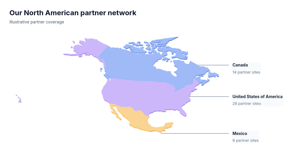
Map: isometric North America territories
MaxFixed real Canada, United States and Mexico outlines form one shallow solid geographic assembly. Every country piece supplied by the generalized basemap remains in place, with a direct country-owned caption retaining one short business fact.
Categories
Included in
Max
When to use it
A North American market-coverage overview for sales partnerships, recruiting coverage or distribution presence. Supports exactly the grounded Natural Earth identifiers CAN, USA and MEX, each once with a supplied short business fact. All 41 country polygons in the licensed 110m source remain, including the supplied Alaska, Hawaii and Canadian island pieces; no insets, island inflation or mainland crop. Fixed north-up Albers geography is gently viewed obliquely, with uniform nonquantitative thickness. Country area and color do not encode business magnitude; no locations, routes, quantitative shading or unspecified facts are inferred.
Adjust after generating
Change the style, colors, and font, and these options, as often as you like without spending credits.
- Typography
- Material
What you fill in
Describe your topic in plain words and the AI fills these in. You can edit every field afterwards.
- Entries
- Exactly 3, each with id and description
Related templates
All map templates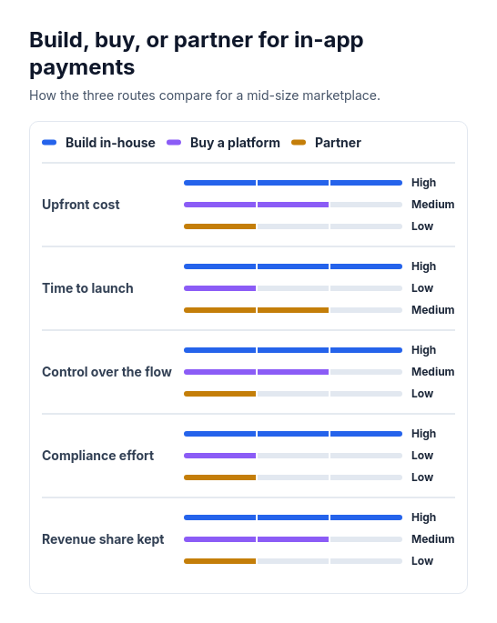 Attribute barsCompare two or three options across three to six attributes that can be scored or rated low, medium, or high, such as cost, speed, and effort.
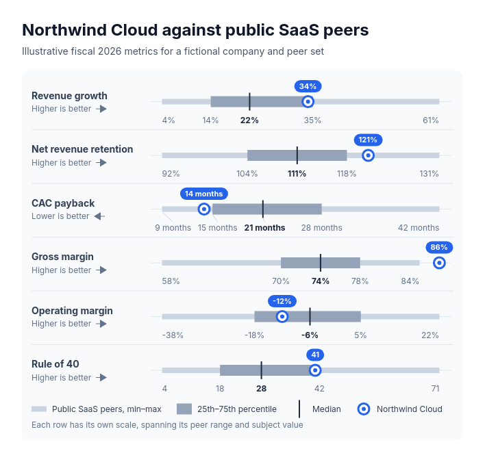 BenchmarkPlace one subject against a peer group's spread on two to eight metrics with different units: company or product benchmarks, a store or region against its network, salary or offer positioning against a market survey, a team or school against its organization.
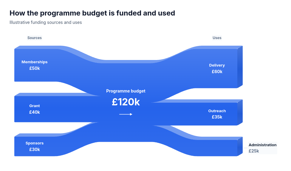 Conserved wholeTwo complete nonnegative marginal breakdowns of one positive common-unit total: funding sources and uses, staffing hours and work allocations, or energy supply and end uses.
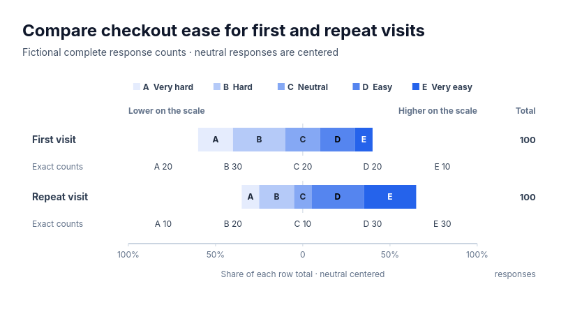 Chart: five-class ordered scaleFor complete supplied counts on one five-class ordered scale compared across two or three groups: survey agreement by segment, review star ratings by product, risk ratings by business unit, performance grades by team or difficulty ratings by release.
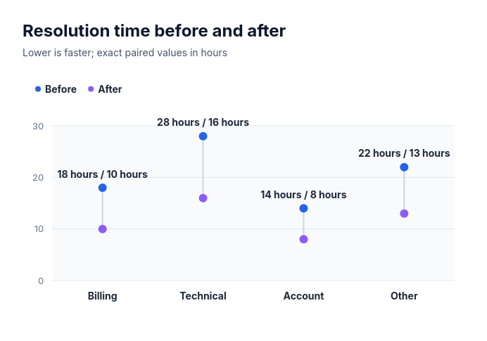 Dumbbell: vertical paired valuesCompare 2–8 paired signed finite before and after amounts as linked vertical points on one common axis.
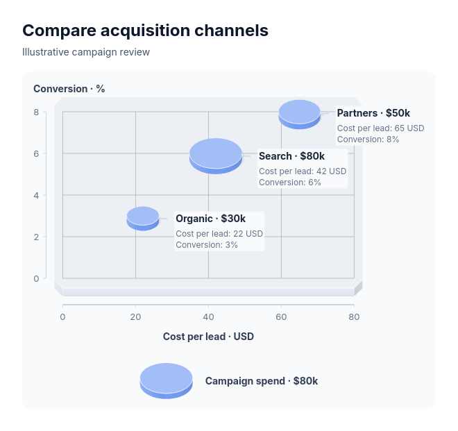 Bubble chartAcquisition channels by cost and conversion with spend, stores by traffic and sales with staffing, or products by growth and margin with revenue.